

Long Beach Island... she's truly majestic, isn't she? Eighteen miles of sandy white beaches with Old Barney standing guard at her North. She's a siren- her salt air and sea breeze to call us back summer after summer. And every visit to her feels better than the last.

celebrating The history, heritage, & homes of Long beach island, nj
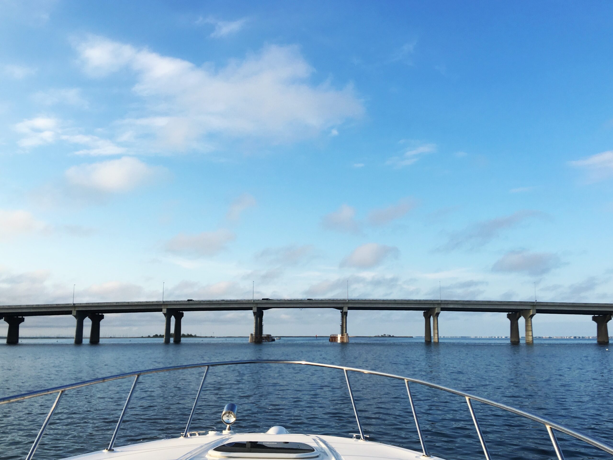
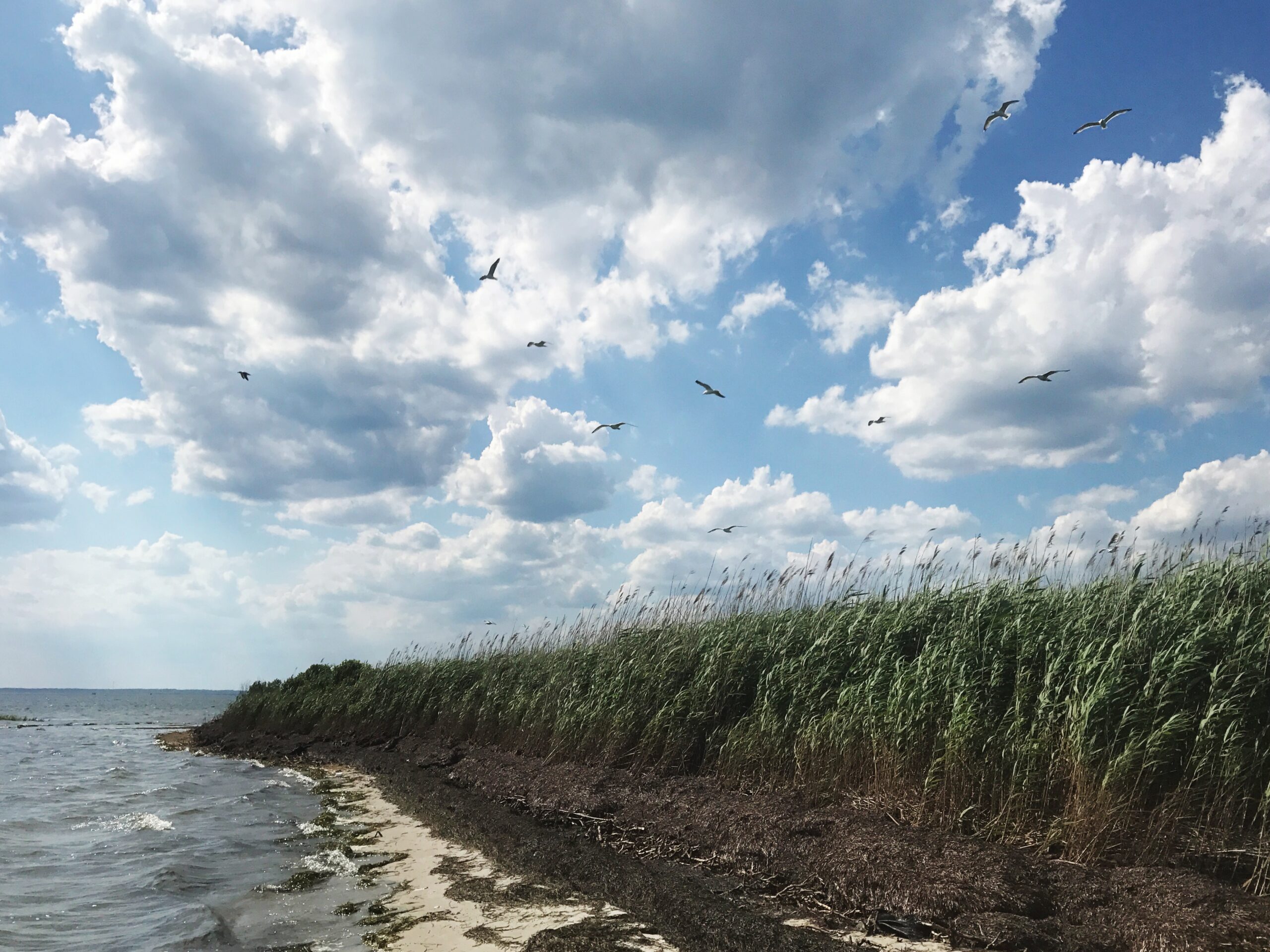
You drive over it every time you cross the causeway. But do you actually know which bay you’re looking at?
celebrating The history, heritage, & homes of Long beach island, nj

Most people who visit Long Beach Island use the words “Barnegat Bay” as a catch-all for every stretch of water between the mainland and the island. And honestly, it’s hard to blame them — when you’re crossing the Route 72 bridge with the windows down and the salt air hitting you for the first time all week, the last thing on your mind is hydrological boundaries.
But the water beneath that bridge? That’s not Barnegat Bay. That’s Manahawkin Bay. And the distinction matters more than most people realize — not just geographically, but historically, ecologically, and in the way these waters have shaped life on this island for centuries.
Two Bays, One Estuary
Here’s the lay of the land — or, more accurately, the lay of the water.
The entire stretch between the Jersey Shore mainland and the barrier islands is technically the Barnegat Bay–Little Egg Harbor Estuary, a lagoonal system that runs nearly 44 miles along the Atlantic coast of Ocean County. Within that system sit three distinct bodies of water: Barnegat Bay to the north, Manahawkin Bay in the middle, and Little Egg Harbor to the south. They’re connected, they share tidal flows, and they function as a single ecosystem. But they are not the same body of water.
Think of it like this: Barnegat Bay is the big sibling. Manahawkin Bay is the quieter middle child. And Little Egg Harbor is the one who moved south and doesn’t get nearly enough credit.
Where One Ends and the Other Begins
The boundary between Barnegat Bay and Manahawkin Bay isn’t marked with a buoy or painted on the water. But the generally accepted dividing line runs along the area near the Route 72 causeway — roughly where Barnegat Bay narrows as it approaches the bridge from the north. North of Route 72, you’re in Barnegat Bay. Cross under the bridge heading south, and you’re in Manahawkin Bay waters.
Manahawkin Bay stretches about four miles in a north-south direction, with the mainland of Stafford Township — including the community of Manahawkin — to the west and Long Beach Island to the east. It’s relatively narrow, averaging one to two miles wide, with a total surface area of roughly 3.6 square miles. The Intracoastal Waterway threads through it, providing the main navigable channel, but the bay is shallow — averaging less than seven feet deep, with some areas near the marshes dropping to less than three feet at low tide.
To the south, Manahawkin Bay transitions into Little Egg Harbor, another shallow estuary that opens up considerably as the barrier island curves toward its southern tip at Holgate.
The South Border: Where Great Bay Enters the Picture
And then there’s Great Bay.
If Manahawkin Bay is the quiet middle child, Great Bay is the wild cousin who lives just around the bend. Located to the south and southwest, Great Bay sits in both Ocean and Atlantic Counties, roughly ten miles north of Atlantic City and about five and a half miles southwest of Beach Haven. The Mullica River flows into it, forming one of the most ecologically significant estuary systems on the entire northeastern seaboard — the Mullica River–Great Bay Estuary.
Great Bay connects to the Atlantic Ocean through Little Egg Inlet, and together with Little Egg Harbor, it forms the southern boundary of the broader waterway system that flanks Long Beach Island. The bay averages about five feet in depth, and its waters support extensive eelgrass beds and submerged aquatic vegetation — an indicator of just how clean and undisturbed these waters remain.
In fact, Great Bay is considered one of the least-disturbed marine wetland habitats in the entire northeastern United States. While Barnegat Bay to the north has faced well-documented challenges with nitrogen runoff, algal blooms, and declining water quality, Great Bay has remained remarkably pristine — largely because the Mullica River watershed is dominated by Pine Barrens forest, which filters water naturally through sandy, acidic soils before it reaches the estuary.
Little Egg Harbor Township is the only community in Ocean County that shares a coastline with both the Barnegat Bay system and Great Bay, making it a unique crossroads between two very different marine environments.
A Brief History of Barnegat Bay
Barnegat Bay is the name most people know — and for good reason. It’s the largest of the three sub-bays, stretching roughly 30 miles along the coast, separated from the Atlantic Ocean by the Island Beach peninsula to the north and Long Beach Island to the south.
The bay’s history reaches back to 1609, when Henry Hudson sailed past and described what he saw as a great lake of water with many shoals and breaking seas at its mouth. Five years later, Dutch explorers gave it the name “Barendegat” — “Inlet of the Breakers” — a reference to the turbulent waters of Barnegat Inlet.
During the American Revolution, the bay served as a refuge for American privateers who used the shallow, shifting channels to evade British warships. By the 19th century, Toms River had grown into a significant whaling port, and the bay became a center for commercial fishing that sustained generations of baymen and their families.
The bay also found its way into popular culture. E.B. White set one of his Preposterous Parables in Barnegat Bay. And Frankie Valli — a Jersey boy to his core — immortalized the bay in his 1975 number-one hit with a reference to walking home over Barnegat Bridge and Bay.
Today, three bridges cross Barnegat Bay: the Mantoloking Bridge connecting Brick Township to Mantoloking, and the Thomas A. Mathis and J. Stanley Tunney Bridges from Toms River to Ortley Beach. The bay is part of the Atlantic Intracoastal Waterway and connects northward to the Point Pleasant Canal.
A Brief History of Manahawkin Bay
Manahawkin Bay doesn’t have the name recognition of its northern neighbor, but its story runs just as deep.
The name “Manahawkin” itself comes from the Lenape language. For generations, it was understood to mean “land of good corn.” More recent scholarship has suggested a translation closer to “fertile land sloping into the water” — which, if you’ve ever stood on the western shore and watched the marshes ease into the bay at low tide, feels far more accurate.
The Lenape — specifically the Unalachtigo subtribe — inhabited this coastal region for more than 10,000 years. They traveled established trails from the interior forests to the shore each summer, harvesting oysters, clams, and fish from the bay’s estuarine waters using spears, nets, and weirs. Shell middens along the mainland shore tell the story of a people who understood these waters intimately, long before anyone thought to draw a map.
European settlement came early. By 1758, the Free Church of Manahawkin was established — the first church in what would become Ocean County. Early settlers clustered near the bay or along the cedar swamps, building an economy around clamming, oystering, boat building, and cedar cutting. The waterways were everything — the means of moving people and product in a region where roads were slow to come.
The bay also saw its share of conflict. During the American Revolution, the Manahawkin area became a flashpoint for New Jersey’s bitter internal civil war between Patriots and Loyalists. The Manahawkin Skirmish of December 1781, led by the notorious Loyalist Captain John Bacon, took place near the Old Manahawkin Baptist Church. And the region may hold the distinction of hosting the last recorded land battle of the Revolution, at Cedar Bridge Tavern in December 1782.
By the mid-1800s, the oystering industry around Manahawkin Bay was booming. Baymen worked the shallow waters, supplying oysters that became renowned in the markets of New York and Philadelphia. Boat builders, shuckers, and fishermen built their lives around the rhythm of the tides. It was hard work, governed by the seasons, and it created a culture of self-reliance and deep connection to the water that still echoes in the communities along these shores.
The bay’s role shifted again in the 20th century. The Pennsylvania Railroad connected Long Beach Island through Manahawkin from 1886 to 1935. The first automobile bridge to LBI was built through Stafford Township in 1914. And when the Beach Haven West lagoon development began in 1945 — eventually becoming the largest lagoon development in New Jersey — Manahawkin Bay moved from a working waterway to the front porch of a growing shore community.
Today, you cross it every time you take the causeway to LBI. The Manahawkin Bay Bridge — officially the Dorland J. Henderson Memorial Bridge — carries Route 72 over the water, its “String of Pearls” lights glowing against the dark bay on summer nights. It is, for most visitors, the first and last thing they see of the bay. But what lies beneath and beyond that bridge is a waterway with a story far older than the road that crosses it.
Why It Matters
Knowing the difference between these bays isn’t just trivia for boaters and fishermen (though they’ll certainly appreciate it). It’s about understanding the place you love — or the place you’re just starting to fall for.
Barnegat Bay, Manahawkin Bay, Little Egg Harbor, and Great Bay are all part of the same interconnected system, but each has its own character, its own history, and its own ecological story. The more you understand the water, the more you understand the island it surrounds.
And next time you’re crossing the causeway with the windows down, you’ll know exactly which bay is catching the light.
See you over the bridge.
Sources & Further Reading
– Barnegat Bay, Wikipedia — History, geography, and cultural references for Barnegat Bay.
– Manahawkin Bay, Grokipedia — Detailed overview of Manahawkin Bay’s ecology, boundaries, and colonial history.
– Great Bay (New Jersey), Wikipedia — The Mullica River–Great Bay estuary and its ecological significance.
– History of Stafford Township, Stafford Township, NJ — Lenape origins, the meaning of “Manahawkin,” Revolutionary War conflicts, and early industry.
– The Barnegat Bay Watershed, Barnegatbay.org — The connected estuary system and watershed ecology.
– About Barnegat Bay, Barnegat Bay Shellfish — The Barnegat Bay Complex and its three sub-bays.
– From Bogs to Beaches: A Brief History of Industry in Manahawkin, Patch — Cedar industry, oystering, and the railroad era in Stafford Township.
– Little Egg Harbor, The Real New Jersey — Little Egg Harbor’s unique position between Barnegat Bay and Great Bay.
– Manahawkin Bay Bridge, Wikipedia — The Dorland J. Henderson Memorial Bridge and its history.
Long Beach Island... she's truly
majestic, isn't she? Eighteen miles of sandy white beaches with
Old Barney standing guard at her North. She's a siren- her salt
air and sea breeze to call us back summer
after summer. And every visit to
her feels better than the last.
TOp Stories
There are some names on Long Beach Island that just are. You don’t question them. You don’t Google them at the beach. You just say them — the way your parents said them, the way their parents said them before that.
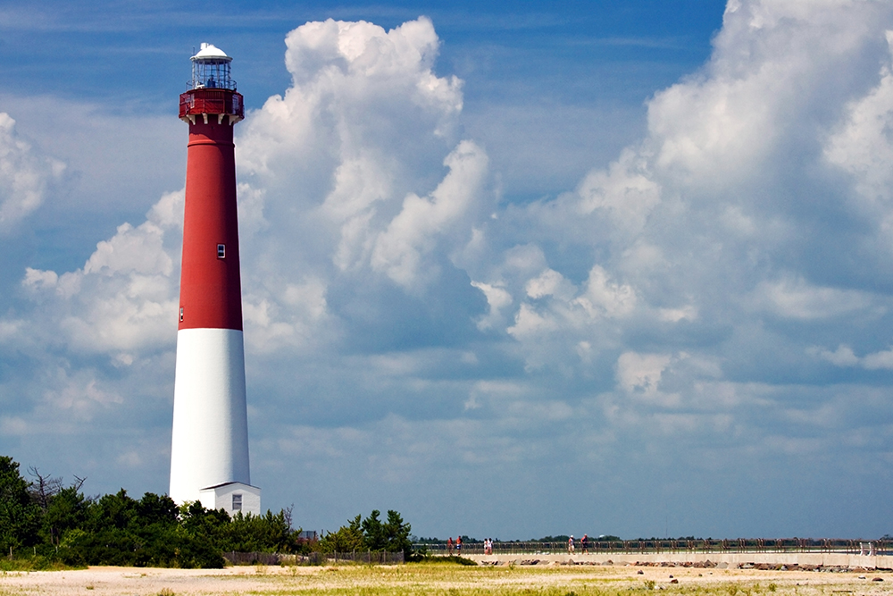
Old Barney is one of those names.
The 172-foot lighthouse standing guard at the northern tip of LBI has been “Old Barney” for so long that most people assume the nickname is self-explanatory. It’s old. It’s the Barnegat Lighthouse. Old Barney. Done.
But if you pull that thread — and I mean really pull it — the story goes back further than the lighthouse itself. Further than George Meade’s tower. Further, even than the English language on this coastline.
So who is Old Barney? Let’s trace the name to the beginning.
It Starts With The Dutch
Long before anyone built a lighthouse here, Dutch explorers were charting the Jersey coastline. In 1614, Captain Cornelius Mey — the same Mey who gave Cape May its name — encountered a turbulent inlet along the barrier islands. The water churned. The shoals shifted. The currents pulled.
He described it with a Dutch term: Barndegat.
The conventional story says the original word was Barendegat, meaning “inlet of the breakers” — a reference to the violent surf crashing through the narrow channel. And for generations, that’s the version that stuck in the history books. But the etymology isn’t quite that clean.
As Keith Germain meticulously documented in his 2020 research paper The Case for Barndegat, the word “Barendegat” doesn’t actually exist in the Dutch language. The word gat does — meaning hole, gap, channel, or harbor. Germain argues that the original term was likely Barndegat, not Barendegat, and that Mey may have been describing something that reminded him of a dijkdoorbraak — a dike breach back home in the Netherlands. The swift waters of the inlet pouring into the vast bay behind it would have looked eerily familiar to a Dutch sailor who’d seen floodwaters breach the dikes of his homeland.
Robert Juet, Henry Hudson’s first mate, had described the bay just a few years earlier as “a great lake of water” composed of “drowned land.” To a Dutchman, that description would have conjured something very specific.
Whether Barndegat was a proper name or a description, the word evolved over the centuries — from Barendegat to Barndegat to Barnegat — as it passed through English-speaking mouths and onto English-made maps.
And it was on one of those English maps that “Old Barney” may have first appeared.
The Map on Charing Cross
In 1778, William Faden — the official cartographer to King George III — published The Province of New Jersey, Divided into East and West, Commonly Called the Jerseys from his shop on Charing Cross in London. It was the finest map of New Jersey produced in the 18th century, built from Bernard Ratzer’s military surveys and enriched with intelligence from British and Hessian officers during the Revolution.
Faden’s map captured extraordinary detail: every road, every river, every township. But tucked into the coastline near the inlet, he printed something cartographers hadn’t used before.
As Kent Mountford notes in Closed Sea: From the Manasquan to the Mullica, A History of Barnegat Bay, Faden “carefully printed a ‘Barigate Inlet’ opening into ‘The Sound’ which lay behind ‘Old Barnegat Beach,’ the latter term being perhaps a concession to popular usage.”
Read that again. Old Barnegat Beach. In 1778. More than eighty years before the current lighthouse was even built.
This means “Old Barnegat” wasn’t a 20th-century nickname used to rally preservationists. It wasn’t coined by a local newspaper or a tourism board. The “Old” was already attached to this stretch of coastline when the Revolution was still being fought — printed by the king’s own mapmaker, likely reflecting what locals had been calling it for years before ink ever hit paper.
From Old Barnegat to Old Barney is barely a slur of the tongue. The kind of shorthand that happens naturally when a name gets passed between fishermen and lifesavers, keepers and their families, visitors and the people who served them fried clams at the end of the island.
But The Locals Tell It Differently
Of course, not everyone on LBI learned their history from 18th-century cartography. Some learned it from a poem — and a much better story.
There’s an old piece of shore folklore that offers a decidedly more colorful explanation for the name. It goes something like this:
A jolly sailor — “a jolly, jolly tar” — spotted the lightkeeper’s daughter on the beach and chased her across the sand until he caught her. When he demanded a kiss, she squealed and called for her father. The sailor introduced himself: “Sure my name is Barney Flynn.”
The old lightkeeper wasn’t having it. He went after the sailor, who made a run for the water. And the place where Barney “gat” — as in got to — the water became “Barnegat.”
Barney gat for the water. And so the place, from near and far, was named.
Is any of it true? Probably not. But that’s never stopped a good story on this island.
Like all good shore lore, it carries a grain of emotional truth. This coastline has always been a place where land and sea collide — where people chase things and get chased, where the tide decides who stays and who goes.
And if you squint, there’s something poetic about the idea that “Old Barney” isn’t a place at all. It’s a person — a jolly, ornery, persistent character who refuses to leave.
Which brings us to the lighthouse.
When Old Barney Became A Battle Cry
Whatever the nickname’s origins, it became something more powerful in the 20th century. When the sea began swallowing the land around the lighthouse — when the Lighthouse Bureau abandoned the tower and the government refused to fund its preservation — the people of LBI didn’t rally around “Barnegat Lighthouse.”
They rallied around Old Barney.
By the 1920s, the nickname was firmly embedded in the local vocabulary. When a bill allocating $100,000 for the lighthouse’s preservation was introduced in Congress in 1924, it was “Old Barney” the newspapers wrote about. When the Lighthouse Bureau submitted an inflated cost estimate and the Department of Commerce walked away, it was “Old Barney” the community refused to let die.
Mayor Butler and the citizens of Barnegat City built an emergency jetty out of old cars, trucks, and baby carriages. By 1933, the water sat just two feet from the tower’s foundation at high tide. The federal government eventually returned to the fight in 1934, funding steel rings around the base — but only after the locals had already proven they’d sink every jalopy on the island before they’d let their lighthouse fall.
The nickname carried weight because it carried affection. “Old Barney” wasn’t a formal designation. It was the way you’d talk about a stubborn, beloved relative who’d outlived everything that tried to take him down.
The Name That Stuck
So who is Old Barney?
Old Barney is a Dutch word that lost its vowels. A stretch of beach that earned the word “Old” before the Revolution. A sailor who chased a girl across the sand. A tower that nearly fell into the sea while its neighbors built jetties out of junk cars.
Old Barney is what happens when a place gets loved long enough that formality falls away and all that’s left is the name people actually use — the one that feels like home.
The nickname didn’t come from a single moment or a single map. It accumulated, the way sand accumulates against a jetty. Layer by layer. Dutch tongues and English pens. A cartographer in London and a fisherman on the inlet. A folk poem and a preservation fight.
And now, 167 years after Meade’s tower first threw its light across the shoals, the name is so deeply embedded in the identity of Long Beach Island that the island itself is — quite literally — south of Old Barney.
See you over the bridge.
Sources & Further Reading
Kent Mountford, Closed Sea: From the Manasquan to the Mullica, A History of Barnegat Bay (Down The Shore Publishing). The William Faden map reference and “Old Barnegat Beach” citation appear in Mountford’s discussion of early cartography of the Barnegat region.
Keith A. Germain, The Case for Barndegat: A Journey from Barendegat to a Burning Hole (November 2020). A detailed etymological analysis of the Dutch origins of “Barnegat,” challenging the conventional “Barendegat” narrative.
William Faden, The Province of New Jersey, Divided into East and West, Commonly Called the Jerseys (London: Charing Cross, 1778). The landmark Revolutionary-era map of New Jersey.
Elinor DeWire, “Old Barnegat Light: What’s in a Name?” (2014). Lighthouse historian’s account of the Barney Flynn folk poem and the Dutch etymology.
Lighthousefriends.com, “Barnegat Lighthouse, New Jersey.” Detailed preservation history, including the 1920s-1930s community fight to save the tower.
Edwin Salter, A History of Monmouth and Ocean Counties (1890). Early documentation of the Barnegat name evolution.
David Gold, Studies in Etymology and Etiology (2009). Scholarly analysis of the Dutch linguistic roots of New Jersey place names.
read ALL POSTS
Every person on this island has an opinion about where to get coffee. And they will defend that opinion like it’s a property line dispute.
This is the question that starts fights at the beach chair line, divides families at rental houses, and has been known to determine which direction you turn off the causeway in the morning. It’s not really about coffee. It’s about loyalty. It’s about ritual. It’s about your LBI.
So we’re starting this series exactly where it should start — with the cup in your hand.
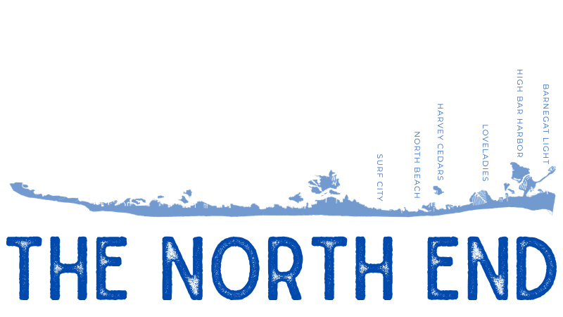
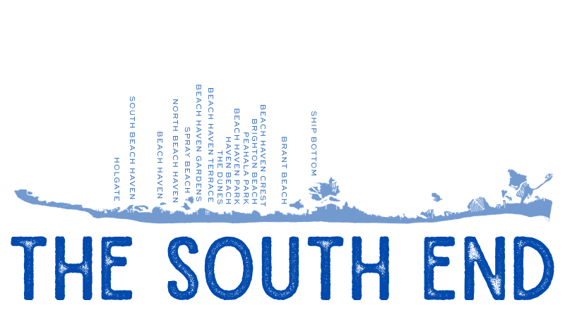
Welcome to North End, South End, or Mainland — a recurring series where we put three zones of island life side by side and let you decide which one gets your heart. (And your money. And your parking spot at 8 a.m. on a Saturday in July.)
The rules are simple: three picks per zone, no chains, no Dunkin’ debates. Just the spots that locals actually go back to — and why.
Let’s brew.
How You Brewin’ — Surf City & Barnegat Light
📍 8 Long Beach Blvd, Surf City (flagship)
If you’ve been coming to LBI for more than five minutes, you’ve been to How You Brewin’. The Surf City flagship is the largest coffee shop on the island — a full-service coffee bar, a café menu, a mocktail bar, and a quiet work section that actually stays quiet. It’s the unofficial town hall of the north end. Half the island’s summer plans have been made at those tables.
But the Barnegat Light location? That’s the one the regulars whisper about. Tucked into the Historic Viking Village, you’re drinking your coffee while fishing boats come and go in the harbor. Their signature Barnegat Light Blend is a light roast that tastes like the north end feels — bright, clean, and a little salty around the edges. It’s seasonal, so don’t sleep on it.
What to Order: Iced salted caramel latte at Surf City if you’re staying. Barnegat Light Blend to-go if you’re walking to the lighthouse.
Surfside Coffee House — Surf City
📍 1901 Long Beach Blvd, Surf City
Surfside is a 2004 original. No frills, no fuss, no credit cards — yes, it’s cash only, and yes, you will forget this and have to run to the ATM in your flip-flops. It happens to everyone at least once.
What keeps people coming back for two decades isn’t the ambiance (it’s a grab-and-go, not a lounge). It’s the award-winning breakfast burritos. The coffee is strong, the blended drinks are solid, and the smoothies and fresh juices round out the menu. But the burritos are why there’s a line out the door before the lifeguards are even in their chairs.
What to Order: Breakfast burrito + whatever coffee you want. You’re not here to overthink it. Bring cash.
Birdy’s Café & Artisan Market — Harvey Cedars
📍 6407 Long Beach Blvd, Harvey Cedars
Birdy’s is the north end’s best-kept secret, and it’s not really a secret anymore. It’s a café and a local artisan market rolled into one — craft coffee, homemade food, baked goods, and a marketplace stocked with products from local farms and makers, including Jersey-caught seafood.
The bayside views and indoor/outdoor seating make it the kind of place where you sit down for a coffee and leave two hours later with a loaf of bread, a bag of someone’s homemade granola, and a renewed appreciation for the north end’s quieter pace. It’s not just a coffee stop. It’s a whole morning.
What to Order: Coffee and whatever toast or pastry looks best that morning, then browse the market. You’ll buy something. Everyone does.
The Local Market & Kitchen — Ship Bottom
📍 604 Central Ave, Ship Bottom
The Local is the first coffee you can get after you cross the bridge — and a lot of people never make it any farther. It sits right at the foot of the causeway in Ship Bottom, and it’s been holding that spot down since 2016.
But calling it a coffee shop doesn’t really cover it. It’s a market, a kitchen, a bakery, and a café all sharing one beautiful, beachy space — white subway tile, reclaimed wood, and an Airstream parked out front that sets the tone before you even walk in. The coffee menu goes deep: nitro cold brews in flavors like Hawaiian Macadamia, specialty lattes like S’mores and Mexican Churro, plus the kind of baked goods and sandwiches that turn a quick coffee run into a full morning. They also stock local artisan products, prepared foods, and grab-and-go options for the beach.
It’s the south end’s most versatile coffee stop — whether you need a latte and a pastry at 7 a.m. or a sandwich and a cold brew at 2 p.m., The Local has you covered.
What to Order: Hawaiian Macadamia nitro cold brew if you want to feel like you’re on vacation. S’mores latte if you already are.
Guapo’s Coffee House — Beach Haven
📍 106 N Bay Ave, Beach Haven
Guapo’s showed up in 2023 and immediately became the south end’s “it” coffee spot. Small-batch specialty coffee, artisan toasts, a full juice and baked goods menu — and a rooftop deck with Beach Haven views that makes you wonder why every coffee shop doesn’t have one.
But here’s the real reason Guapo’s wins the internet every summer: it’s dog-friendly in all outdoor areas, they serve pup cups, and they’ll photograph your dog for their iconic dog wall. If your golden retriever has more Instagram followers than you do, this is your place.
What to Order: Iced coffee on the rooftop with your dog. Order a toast. Get the photo for the wall.
Cool Beans LBI — Beach Haven
📍 830 N Bay Ave, Beach Haven (Bay Village)
Cool Beans has been in Beach Haven since 1993. Let that sink in — this family-owned spot has been serving coffee on this island for over thirty years. Before the cold brew craze, before oat milk, before anyone was putting lavender in a latte, Cool Beans was here, quietly roasting and pouring.
The menu is old-school in the best way: French Roast, Italian Espresso, and flavored options like Almond Biscotti, Cinnamon Hazelnut, Hawaiian Surprise, and — trust me on this one — Whiskey Barrel. It’s cozy, it’s personal, and the staff actually knows what they’re doing because they’ve been doing it for three decades.
What to Order: French Roast if you’re a purist. Whiskey Barrel if you want to know what thirty years of flavor experimentation tastes like.

Yellow Dog Coffee Roasters — Manahawkin
📍 420 N Main St, Manahawkin
Every great coffee story starts somewhere weird. Yellow Dog’s starts with a popcorn maker.
Owner Dave Smithman — a Barnegat native living in Manahawkin — started roasting beans at home in 2019, selling to friends and family. He grew it through farmers markets, wholesale, and a coffee trailer called “The Coffee Can” before opening this brick-and-mortar storefront. The company is named after his yellow Lab, Oakley, because the dog “seemed to embody our message perfectly — appreciate the little things, enjoy the company of family and friends, and love the outdoors.”
If that doesn’t sound like an LBI business, I don’t know what does. Yellow Dog roasts on-site, offers a full espresso menu with seasonal specialties, and the vibe is genuinely warm — not curated warm, actually warm. It’s dog-friendly, too. (Obviously.)
What to Order: Ask what’s freshly roasted that day. Grab a bag of beans to take home. You’ll be back.
Agnello’s Café — Manahawkin
📍 657 E Bay Ave, Unit 2, Manahawkin
Agnello’s is the one that bridges the island and the mainland — they’ve got locations in Barnegat Light and Harvey Cedars, too, but the Manahawkin café has become its own thing. Organic, fair-trade espresso. Sandwiches on homemade sourdough that people drive out of their way for. House-made syrups in flavors like Earl Grey, sea salt, and blueberry vanilla.
The vibe is clean and intentional without being pretentious. Reviewers rave about the iced Fredo and the pistachio vanilla latte. The breakfast sandwiches — especially the bacon, egg, and cheese with bacon jam on sourdough — have developed a quiet cult following.
What to Order: Iced Fredo + the bacon jam breakfast sandwich on sourdough. Don’t argue with me. Just order it.
GNM Coffee Shop — Barnegat
📍 237 S Main St, Barnegat
Technically Barnegat, but right in the mainland corridor and very much part of the Manahawkin-area coffee conversation. GNM is the one with the gnomes. Yes, gnomes. The whole café is decorated with whimsical gnome decor, which sounds like a lot until you’re sitting there with a churro latte topped with an actual churro, and suddenly it all makes sense.
The menu is creative without trying too hard — marshmallow lattes, smoked salmon toast, homemade cinnamon buns, and solid avocado toast. There’s indoor and outdoor seating, the staff is friendly, and the whole place feels like someone opened the coffee shop they actually wanted to hang out in. That’s the best kind.
What to Order: Churro latte. It comes with a churro on top. That’s it. That’s the move.
HONORABLE MENTIONS
Because nine picks was never going to be enough and my inbox would never recover if I didn’t mention these two.
The Coffee Bouteaque — 325 9th St, Beach Haven A boutique coffee shop tucked inside a boutique — La Colombe coffee, Oliver Pluff teas, fresh baked goods, and mermaid-themed everything (shirts, mugs, beer glasses). It’s the kind of place that feels like a girlfriend texted you “meet me here” and you instantly understood why. If you’re not a coffee person, the tea selection alone is worth the stop.
The Mermaid Room — 1920 Long Beach Blvd, Ship Bottom Same boutique-meets-coffee-bar concept, different location. The Mermaid Room lives inside Beach Barn Boutique in Ship Bottom, also serves La Colombe and Oliver Pluff, and is run by a local LBI family. The specialty lattes (the turmeric is a fan favorite) are worth the detour, and you’ll leave with at least one thing you didn’t come in for. That’s the boutique magic.
So… Where Do You Stand?
Here’s the thing about the coffee question on LBI: there’s no wrong answer. The north end people will swear by their spot. The south end people already have a table with their name on it. And the mainland crew knows something the rest of the island is just starting to figure out — some of the best cups are across the bridge.
But I want to hear it from you. Where do you get your coffee? Are you a How You Brewin’ loyalist? A Cool Beans lifer? Did Yellow Dog just change your morning routine?
Drop it in the comments. Tag the friend who gets unreasonably passionate about this. And if you think I missed your spot — tell me. This is a series. There’s always next time.
See you over the bridge.
This is the first post in the North End, South End, or Mainland series on South of Old Barney — where we put LBI’s best side by side and let you pick your favorite. New installments drop regularly. Want them delivered straight to your inbox?
Stamped. Sealed. Delivered from South of Old Barney. →
You drive over it every time you cross the causeway. But do you actually know which bay you’re looking at?
Eighteen miles. Six towns. One mainland gem. Not every stretch of sand was made for the same kind of soul — here’s how to find the one that fits yours.
How one man embodied the eternal nostalgia of an island and took a lifetime of history and wrote it like poetry
read ALL POSTS


the legacy of John Bailey LLoyd as lbi's historian
"Everyone who ever came to this island... came out of pure enjoyment and returned year after year."


The towns and neighborhoods of lbi & the mainland include: barnegat light, High Bar Harbor, Loveladies, harvey cedars, North Beach, surf city, ship bottom, Brant Beach, Beach Haven Crest, Brighton Beach, Peahala Park, Beach Haven Park, Haven Beach, The Dunes, Beach Haven Terrace, Beach Haven Gardens, Spray Beach, North Beach Haven, Beach Haven, South Beach Haven and Holgate PLUS Bonnet, Cedar Bonnet & Mallard Islands, mud city and beach haven west.
the legacy of John Bailey LLoyd as lbi's historian
"Everyone who ever came to this island...
came out of pure enjoyment and
returned year after year."