
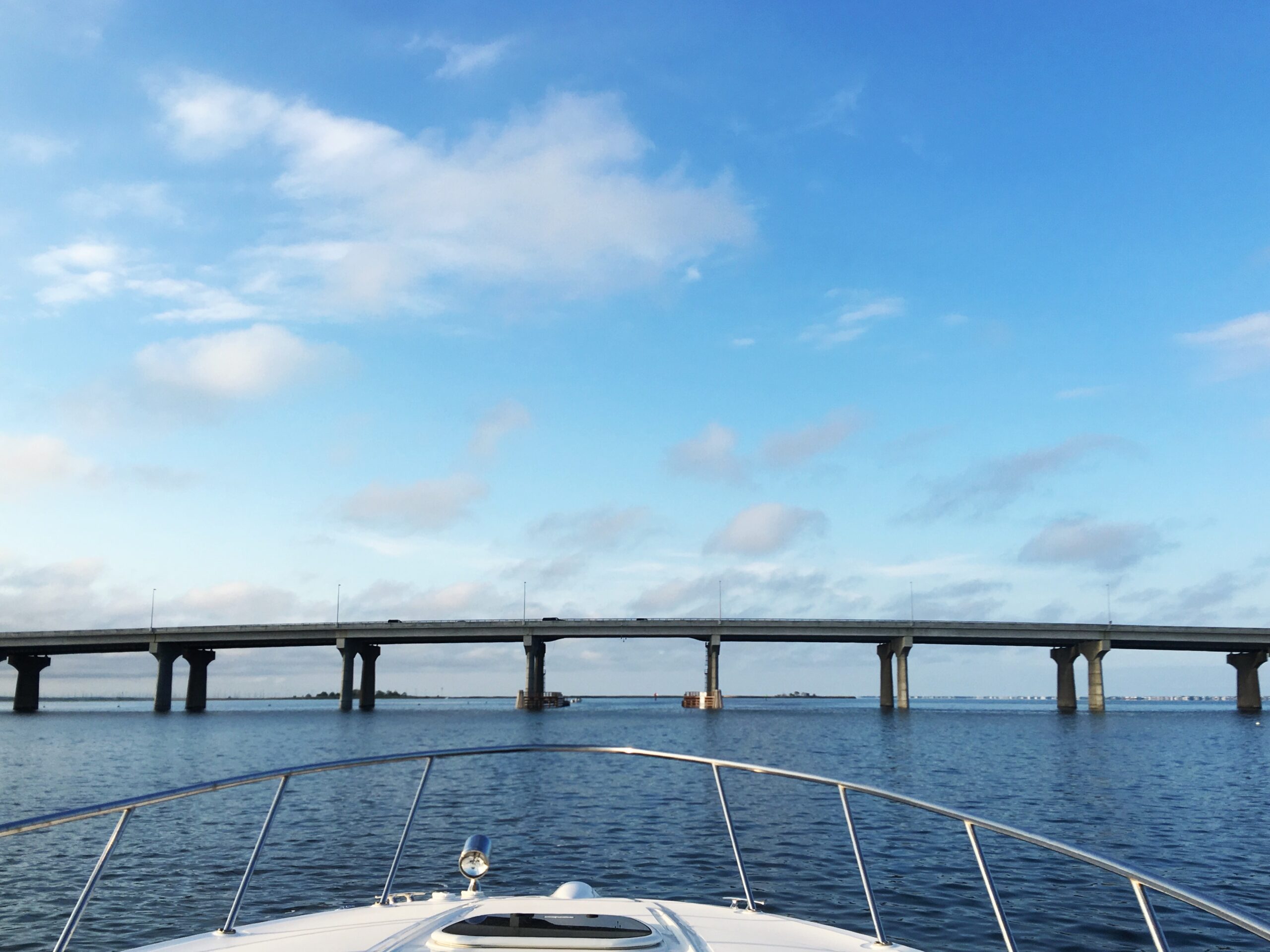


Most people who visit Long Beach Island use the words “Barnegat Bay” as a catch-all for every stretch of water between the mainland and the island. And honestly, it’s hard to blame them — when you’re crossing the Route 72 bridge with the windows down and the salt air hitting you for the first time all week, the last thing on your mind is hydrological boundaries.
But the water beneath that bridge? That’s not Barnegat Bay. That’s Manahawkin Bay. And the distinction matters more than most people realize — not just geographically, but historically, ecologically, and in the way these waters have shaped life on this island for centuries.
Two Bays, One Estuary
Here’s the lay of the land — or, more accurately, the lay of the water.
The entire stretch between the Jersey Shore mainland and the barrier islands is technically the Barnegat Bay–Little Egg Harbor Estuary, a lagoonal system that runs nearly 44 miles along the Atlantic coast of Ocean County. Within that system sit three distinct bodies of water: Barnegat Bay to the north, Manahawkin Bay in the middle, and Little Egg Harbor to the south. They’re connected, they share tidal flows, and they function as a single ecosystem. But they are not the same body of water.
Think of it like this: Barnegat Bay is the big sibling. Manahawkin Bay is the quieter middle child. And Little Egg Harbor is the one who moved south and doesn’t get nearly enough credit.
Where One Ends and the Other Begins
The boundary between Barnegat Bay and Manahawkin Bay isn’t marked with a buoy or painted on the water. But the generally accepted dividing line runs along the area near the Route 72 causeway — roughly where Barnegat Bay narrows as it approaches the bridge from the north. North of Route 72, you’re in Barnegat Bay. Cross under the bridge heading south, and you’re in Manahawkin Bay waters.
Manahawkin Bay stretches about four miles in a north-south direction, with the mainland of Stafford Township — including the community of Manahawkin — to the west and Long Beach Island to the east. It’s relatively narrow, averaging one to two miles wide, with a total surface area of roughly 3.6 square miles. The Intracoastal Waterway threads through it, providing the main navigable channel, but the bay is shallow — averaging less than seven feet deep, with some areas near the marshes dropping to less than three feet at low tide.
To the south, Manahawkin Bay transitions into Little Egg Harbor, another shallow estuary that opens up considerably as the barrier island curves toward its southern tip at Holgate.
The South Border: Where Great Bay Enters the Picture
And then there’s Great Bay.
If Manahawkin Bay is the quiet middle child, Great Bay is the wild cousin who lives just around the bend. Located to the south and southwest, Great Bay sits in both Ocean and Atlantic Counties, roughly ten miles north of Atlantic City and about five and a half miles southwest of Beach Haven. The Mullica River flows into it, forming one of the most ecologically significant estuary systems on the entire northeastern seaboard — the Mullica River–Great Bay Estuary.
Great Bay connects to the Atlantic Ocean through Little Egg Inlet, and together with Little Egg Harbor, it forms the southern boundary of the broader waterway system that flanks Long Beach Island. The bay averages about five feet in depth, and its waters support extensive eelgrass beds and submerged aquatic vegetation — an indicator of just how clean and undisturbed these waters remain.
In fact, Great Bay is considered one of the least-disturbed marine wetland habitats in the entire northeastern United States. While Barnegat Bay to the north has faced well-documented challenges with nitrogen runoff, algal blooms, and declining water quality, Great Bay has remained remarkably pristine — largely because the Mullica River watershed is dominated by Pine Barrens forest, which filters water naturally through sandy, acidic soils before it reaches the estuary.
Little Egg Harbor Township is the only community in Ocean County that shares a coastline with both the Barnegat Bay system and Great Bay, making it a unique crossroads between two very different marine environments.
A Brief History of Barnegat Bay
Barnegat Bay is the name most people know — and for good reason. It’s the largest of the three sub-bays, stretching roughly 30 miles along the coast, separated from the Atlantic Ocean by the Island Beach peninsula to the north and Long Beach Island to the south.
The bay’s history reaches back to 1609, when Henry Hudson sailed past and described what he saw as a great lake of water with many shoals and breaking seas at its mouth. Five years later, Dutch explorers gave it the name “Barendegat” — “Inlet of the Breakers” — a reference to the turbulent waters of Barnegat Inlet.
During the American Revolution, the bay served as a refuge for American privateers who used the shallow, shifting channels to evade British warships. By the 19th century, Toms River had grown into a significant whaling port, and the bay became a center for commercial fishing that sustained generations of baymen and their families.
The bay also found its way into popular culture. E.B. White set one of his Preposterous Parables in Barnegat Bay. And Frankie Valli — a Jersey boy to his core — immortalized the bay in his 1975 number-one hit with a reference to walking home over Barnegat Bridge and Bay.
Today, three bridges cross Barnegat Bay: the Mantoloking Bridge connecting Brick Township to Mantoloking, and the Thomas A. Mathis and J. Stanley Tunney Bridges from Toms River to Ortley Beach. The bay is part of the Atlantic Intracoastal Waterway and connects northward to the Point Pleasant Canal.
A Brief History of Manahawkin Bay
Manahawkin Bay doesn’t have the name recognition of its northern neighbor, but its story runs just as deep.
The name “Manahawkin” itself comes from the Lenape language. For generations, it was understood to mean “land of good corn.” More recent scholarship has suggested a translation closer to “fertile land sloping into the water” — which, if you’ve ever stood on the western shore and watched the marshes ease into the bay at low tide, feels far more accurate.
The Lenape — specifically the Unalachtigo subtribe — inhabited this coastal region for more than 10,000 years. They traveled established trails from the interior forests to the shore each summer, harvesting oysters, clams, and fish from the bay’s estuarine waters using spears, nets, and weirs. Shell middens along the mainland shore tell the story of a people who understood these waters intimately, long before anyone thought to draw a map.
European settlement came early. By 1758, the Free Church of Manahawkin was established — the first church in what would become Ocean County. Early settlers clustered near the bay or along the cedar swamps, building an economy around clamming, oystering, boat building, and cedar cutting. The waterways were everything — the means of moving people and product in a region where roads were slow to come.
The bay also saw its share of conflict. During the American Revolution, the Manahawkin area became a flashpoint for New Jersey’s bitter internal civil war between Patriots and Loyalists. The Manahawkin Skirmish of December 1781, led by the notorious Loyalist Captain John Bacon, took place near the Old Manahawkin Baptist Church. And the region may hold the distinction of hosting the last recorded land battle of the Revolution, at Cedar Bridge Tavern in December 1782.
By the mid-1800s, the oystering industry around Manahawkin Bay was booming. Baymen worked the shallow waters, supplying oysters that became renowned in the markets of New York and Philadelphia. Boat builders, shuckers, and fishermen built their lives around the rhythm of the tides. It was hard work, governed by the seasons, and it created a culture of self-reliance and deep connection to the water that still echoes in the communities along these shores.
The bay’s role shifted again in the 20th century. The Pennsylvania Railroad connected Long Beach Island through Manahawkin from 1886 to 1935. The first automobile bridge to LBI was built through Stafford Township in 1914. And when the Beach Haven West lagoon development began in 1945 — eventually becoming the largest lagoon development in New Jersey — Manahawkin Bay moved from a working waterway to the front porch of a growing shore community.
Today, you cross it every time you take the causeway to LBI. The Manahawkin Bay Bridge — officially the Dorland J. Henderson Memorial Bridge — carries Route 72 over the water, its “String of Pearls” lights glowing against the dark bay on summer nights. It is, for most visitors, the first and last thing they see of the bay. But what lies beneath and beyond that bridge is a waterway with a story far older than the road that crosses it.
Why It Matters
Knowing the difference between these bays isn’t just trivia for boaters and fishermen (though they’ll certainly appreciate it). It’s about understanding the place you love — or the place you’re just starting to fall for.
Barnegat Bay, Manahawkin Bay, Little Egg Harbor, and Great Bay are all part of the same interconnected system, but each has its own character, its own history, and its own ecological story. The more you understand the water, the more you understand the island it surrounds.
And next time you’re crossing the causeway with the windows down, you’ll know exactly which bay is catching the light.
See you over the bridge.
Sources & Further Reading
– Barnegat Bay, Wikipedia — History, geography, and cultural references for Barnegat Bay.
– Manahawkin Bay, Grokipedia — Detailed overview of Manahawkin Bay’s ecology, boundaries, and colonial history.
– Great Bay (New Jersey), Wikipedia — The Mullica River–Great Bay estuary and its ecological significance.
– History of Stafford Township, Stafford Township, NJ — Lenape origins, the meaning of “Manahawkin,” Revolutionary War conflicts, and early industry.
– The Barnegat Bay Watershed, Barnegatbay.org — The connected estuary system and watershed ecology.
– About Barnegat Bay, Barnegat Bay Shellfish — The Barnegat Bay Complex and its three sub-bays.
– From Bogs to Beaches: A Brief History of Industry in Manahawkin, Patch — Cedar industry, oystering, and the railroad era in Stafford Township.
– Little Egg Harbor, The Real New Jersey — Little Egg Harbor’s unique position between Barnegat Bay and Great Bay.
– Manahawkin Bay Bridge, Wikipedia — The Dorland J. Henderson Memorial Bridge and its history.
Comments +